

Share This Article
Featured Image Courtesy of NOAA
Harris County residents can expect increasing cloud cover, cooler temperatures and a chance of rain this weekend, particularly in areas west of Interstate Highway 45. A developing weather system is expected to bring moisture into Southeast Texas, with the greatest rain chances arriving Sunday.
A weak cold front is moving off the coast Friday, allowing cooler, drier air to settle into the region. Meanwhile, another weather system approaching from the west will begin drawing moisture from the Gulf of Mexico and Pacific Ocean into Texas.
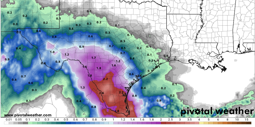
Saturday will remain mostly dry across much of Southeast Texas, although cloud cover will increase throughout the day. A few scattered showers could develop west of the Brazos River by Saturday evening.
Rain chances will increase Sunday, especially west of I-45, as moisture continues to move into the region. However, uncertainty remains about how quickly the dry air near the surface will clear out. Some forecasts suggest most rainfall will remain farther west, while others indicate showers could spread eastward into the Houston area Sunday and Sunday night.
Temperatures will also trend cooler throughout the weekend. By Sunday, most areas are expected to remain in the 60s, with some locations northwest of Houston, including College Station, potentially experiencing temperatures in the lower 60s.
Stay Weather Aware
Although rainfall amounts remain uncertain, residents are encouraged to monitor changing weather conditions throughout the weekend.
The Harris County Flood Control District’s Flood Warning System provides real-time rainfall information, water levels in bayous and creeks, and customizable alerts to help residents stay informed.
Visit www.harriscountyfws.org to monitor local conditions and sign up for rainfall and water-level alerts in your area.
Weather insights provided by Jeff Lindner, Harris County Flood Control District Meteorologist.