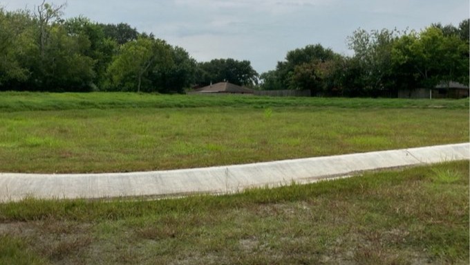
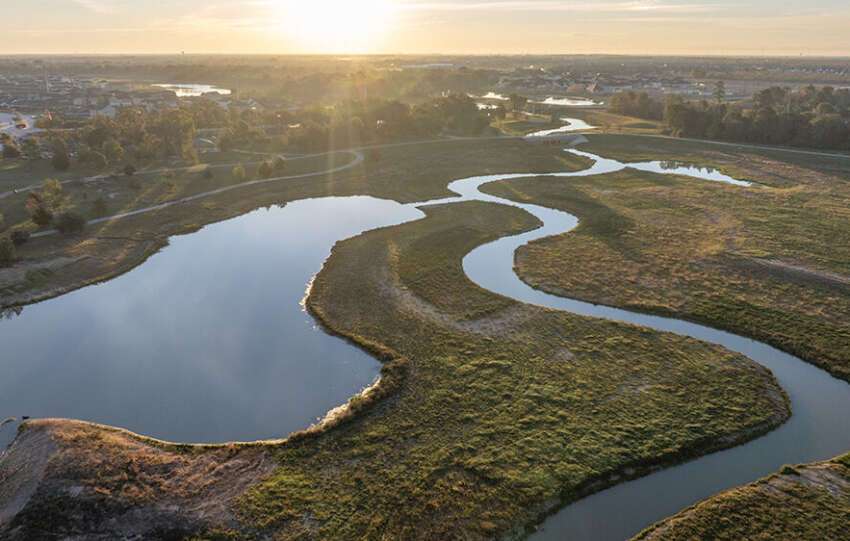
Brookglen Stormwater Basin: Phase 2 is Underway
The Harris County Flood Control District, in partnership with the City of La Porte, began Phase 2 of the Brookglen Stormwater Detention Basin in November 2025. Located near Somerton Drive and Ashwyne Lane, this project is designed to help manage stormwater and reduce the risk of flooding in…
Updated draft FEMA floodplain maps show that thousands of Harris County residents are now mapped out of high-risk floodplain areas because of completed flood risk reduction projects.
During a recent Harris County Commissioners Court meeting, Harris County Flood Control District leadership highlighted an important milestone: Updated draft FEMA floodplain maps now reflect the real impact…
Most people enjoy the occasional slow-paced rainy day. In Harris County, we typically see about 106 days with rainfall each year. Understanding how those rainfall totals add up over time and how stormwater moves throughout Harris County is key to understanding flood risk.
A few inches of rain might not seem like much at first.…
Yesterday, the Harris County Flood Control District provided an update to the Harris County Commissioners Court on newly released Federal Emergency Management Agency (FEMA) draft floodplain maps. This morning, the conversation continued on local television.
On February 13, 2026, Emily Woodell, Chief External Affairs Officer for the Flood Control District, joined FOX 26 Houston to…
Draft floodplain maps for Harris County have officially been released, marking a major milestone in the MAAPNext mapping effort. During today’s Harris County Commissioners Court meeting, Dr. Tina Petersen, Executive Director of the Harris County Flood Control District, emphasized that while the maps are early in the process, the community will have time, access, and…
Last week, FEMA released draft floodplain mapping information to the 34 floodplain administrators in Harris County as part of the MAAPNext effort. MAAPNext is a FEMA-led initiative, supported by the Harris County Flood Control District to provide local expertise. These maps reflect changing conditions in Harris County, including a more than 30% increase in rainfall rates, updated topography and advanced modeling. These updates are…
The Harris County Flood Control District is working to reduce flood risks along the mid-reach stretch of Greens Bayou. The Greens Mid-Reach Program is a long-term multi-project initiative along Greens Bayou from Veterans Memorial Drive to JFK Boulevard. The program is intended to improve channel conveyance along Greens Bayou and provide stormwater storage capacity within…
Every day, the Harris County Flood Control District works to reduce flood risk for communities across Harris County. One important way we do that is by creating space for stormwater to go during heavy rain.
That’s exactly what the Yale Stormwater Detention Basin project is designed to do. It will improve stormwater management and help…
The Harris County Flood Control District recently completed important maintenance work along Bering Ditch in west Houston, within Harris County Precinct 3.
The Flood Control District is responsible for maintaining more than 2,500 miles of channels across the county and regularly inspects the channels and makes repairs when excessive wear or damage is identified.
For…
Strong partnerships are essential to building long-term resilience in Harris County. Through the Community Development Block Grant (CDBG) program, the Flood Control District can design and build projects that meaningfully reduce flood risk. These projects improve channel conveyance, create stormwater storage, and preserve floodplains that help mitigate flooding during major rain events.
Many communities with…
